San Luis Obispo Valley Groundwater Basin
The San Luis Obispo Valley Groundwater Basin, DWR Bulletin 118 Basin No. 3-09 is situated in the San Luis and Edna Valleys in central to southwest San Luis Obispo County. A rise in bedrock south of the San Luis Obispo Airport has created two separate subsurface drainage systems or subbasins (i.e., San Luis Valley and Edna Valley). The basin overlies an area of approximately 12,700 acres (19.9 square miles) and is part of the Central Coast Watershed. The Edna Valley Subbasin (approximately 4,700 acres) is entirely within unincorporated San Luis Obispo County, while the San Luis Valley Subbasin (approximately 8,000 acres) includes both unincorporated County and the City of San Luis Obispo.
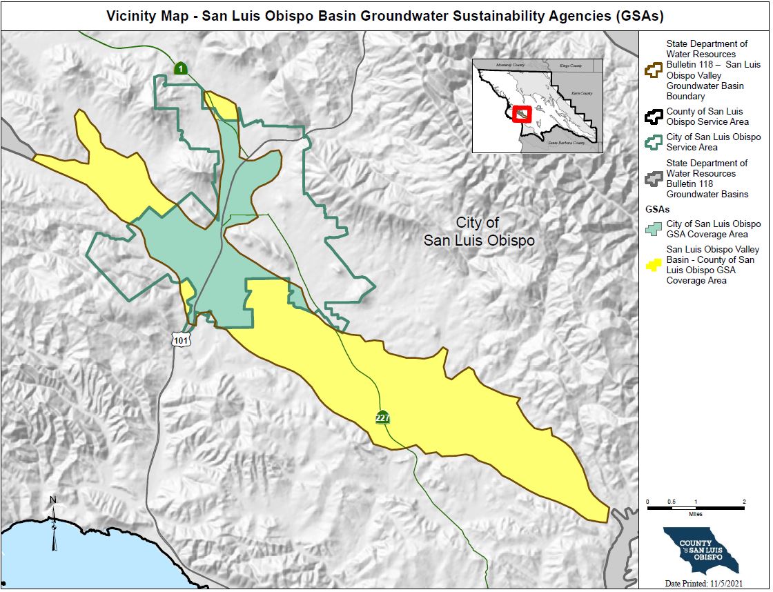
Groundwater Sustainability Plan & Annual ReportingHistoryIn 2015, the State legislature approved an important new groundwater management law known as the Sustainable Groundwater Management Act (SGMA). SGMA requires that high and medium priority basins comply with the new law – DWR designated San Luis Obispo Valley Basin as a high priority basin. The County of San Luis Obispo and the City of San Luis Obispo formed Groundwater Sustainability Agencies within their respective jurisdictions to cover the entire San Luis Obispo Valley Groundwater Basin (SLO Basin). The map below shows those areas subject to SGMA. |
Map Resources
Welcome to the SGMA Interactive Data Viewer for the San Luis Obispo Valley Basin! This is an interactive mapping system to help you to navigate around the San Luis Obispo Valley groundwater basin by panning, zooming, or searching for a specific parcel or street address that you would like to locate. There are different map layers that can be shown and superimposed in this interactive mapping system such as boundaries of groundwater basins, cities, roads, SGMA eligible entities, and others by checking the layer names indicated on the left panel layer menu. To search and locate a specific APN or street address on the map: 1. Enter either the nine-digit parcel number (APN) including hyphens or the complete street address in the “Search...” bar on the upper right hand corner of the map screen and then click on the search button to locate it. The APN or street address that you just entered will appear on the left panel and a location marker will show up on the map to identify the location. 2. Click on the APN or street address name shown on the left panel layer menu will zoom in to the specified location for a close-up look |
How do I get involved?
|
Other Partner Agencies
|
Sign up for the SGMA Mailing ListClick here to subscribe to the SGMA email notification list! |

