Morro Bay
Description
 Morro Bay Watershed
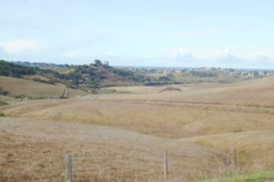
The Morro Bay Watershed is located in the central area of coastal San Luis Obispo County. It is composed of two major sub-watersheds that drain into Chorro and Los Osos Creeks. The Chorro Creek sub-watershed accounts for about 60 percent of the total land area draining into the estuary. Much of the watershed remains in open space that is used primarily for agriculture and a range of public uses, including parks, golf courses, nature preserves, a military base, and university-owned rangeland. The developed portions of the watershed include the community of Los Osos/ Baywood Park, parts of the City of Morro Bay, Cuesta College, Camp San Luis Obispo, the California Men’s Colony, and various facilities of the County of San Luis Obispo. Due to the uniqueness of Morro Bay, the watershed has been studied since the late 1980’s with watershed plans from that era being completed.
WATERSHED OVERVIEW
Hydrologic Unit Name: | Estero Bay HU 10 |
Water Planning Area: | Morro Bay WPA 4, Los Osos WPA 5 |
Acreage: | 46,598 acres |
Flow to: | Pacific Ocean via Morro Bay estuary |
Groundwater Basin(s): | Los Osos Valley, Chorro Valley |
Jurisdictions: | County of San Luis Obispo, City of Morro Bay, Town of Los Osos, Camp San Luis Obispo, California Men’s Colony, California Polytechnical State University, U.S. Forest Service, CA Department of Parks and Recreation |
Watershed Plans: | Morro Bay Comprehensive Conservation Management Plan (MBNEP, 2013) |
Full Data Snapshot
Download the Watershed Snapshot for more detailed information such as:
- Rainfall
- Geology
- Hydrology models
- Vegetation
- Special status wildlife and plants
- Land use
- Demographics
- Major changes in the watershed
- Watershed health
- Groundwater