Nacimiento River
Description
 Nacimiento River Watershed
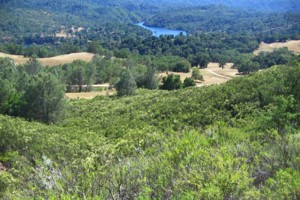
The Nacimiento River Watershed is located at the northern boundary of San Luis Obispo County with a few sub-watersheds located in Monterey County. For the purposes of this snapshot, only those sub-watersheds within SLO County are included in this data compilation. This watershed also contains 6,578 acres of land from the San Antonio Watershed, however, the area within the County is relatively small and best categorized with its neighboring Nacimiento Watershed for the purposes of this project. The Nacimiento Watershed contains Lake Nacimiento, the largest reservoir in San Luis Obispo County totaling 2.26 square miles. The highest elevation in the watershed occurs in the Santa Lucia Range, within the Los Padres National Forest, reaching approximately 3,560 feet above sea level. Lake Nacimiento supplies water to the Salinas Valley and, as of 2010, supplies supplemental water to some communities in San Luis Obispo County. The dominant land use is agriculture with a majority of land used for rural grazing activities.
WATERSHED OVERVIEW
Hydrologic Unit Name: | Salinas 9 |
Water Planning Area: | Nacimiento WPA 16 |
Acreage: | 237,886 acres total / 128,974 acres within San Luis Obispo County (includes 6,578 acres of San Antonio Watershed) |
Flow to: | Salinas River (through Monterey County) to Pacific Ocean (Monterey Bay National Marine Sanctuary) |
Groundwater Basin(s): | Paso Robles, Tierra Redonda Mountain (San Antonio watershed) |
Jurisdictions: | County of San Luis Obispo, Heritage Ranch, Oak Shores, Camp Roberts (ptn) |
Watershed Plans: | San Antonio and Nacimiento Rivers Watershed Management Plan (MCWRA, 2008) |
Full Data Snapshot
Download the Watershed Snapshot for more detailed information such as:
- Rainfall
- Geology
- Hydrology models
- Vegetation
- Special status wildlife and plants
- Land use
- Demographics
- Major changes in the watershed
- Watershed health
- Groundwater