Avila Beach Drainage Project
Project Background:
The intersection of First Street and San Francisco Street and the Avila Beach Parking Lot are prone to flooding throughout the year, regardless of the season, due to its low elevation. A gravity drainage system: consisting of open concrete channels, gutters, pipes, and swale, collects and diverts stormwater the best it can from the intersection along the edge of the lot, across Avila Beach Drive, and into San Luis Obispo Creek. However, the elevation drop between the intersection and parking lot to the creek outlet is very slight.
Furthermore, the creek outlet is a duckbill check valve, which allows the system to discharge with minimal backflow. This presents the issue of tidal and creek level influences. The outlet will not allow the system to discharge when the water level of the estuary is above it, leading to water in the system backfilling into the parking lot and intersection until the estuary water level has dropped.
Project Goals:
The intersection of First Street, San Francisco Street, and the entrance to the Avila Beach Parking Lot floods frequently throughout the year, even after minor storms. If the flooding is severe enough, either in terms of area or time, County Roads crews close the intersection, which separates the surrounding area from the rest of town and restricts parking. On multiple occasions, County Roads has pumped the excess stormwater out of the intersection and up along San Francisco Street towards the Pacific Ocean via a mobile pump. To reduce flooding, by both area and time, and future closings of First Street and the Avila Beach Parking Lot, this project consists of:
• Determining all the participating factors to the flooding.
• Analyzing the surrounding project area and communicating with local stakeholders.
• Identifying a preferred solution and alternatives.
• Designing and constructing the chosen solution.
• Setting up operations and maintenance of the chosen solution.
Current Project Efforts:
The County has hired an outside consultant (GHD) and outside surveyor (MBS Land Surveys) to assist with the project using allocated ARPA funds of $200,000.
GHD action items include reviewing Cannon’s 2015 Conceptual Design Report and 30% designs of a preferred solution and alternatives. MBS Land Surveys action items include topographic and boundaries surveys of the project area.
The County leads the project, utilizing all available ARPA funds in finishing the study phase through completion of 30% designs and an initial draft of a Project Execution Plan (PEP). After, the County hopes to pursue the necessary approval and funding to push for the next phases of the project.
Project Progress:
| Step | Status |
|---|---|
| Peer Review of Cannon Conceptual Report | Complete |
| Topographic Survey | Complete |
| Boundaries Survey | Complete |
| Conceptual Design Analysis | Complete |
| 30% Design(s) | Ongoing |
| Project Execution Plan | Ongoing |
| Project Approval | Awaiting 30% Design and PEP |
| Project Funding | Awaiting 30% Design and PEP |
| Community Meeting | Not Started |
| Stakeholder Meeting | Not Started |
| 60% Design | Not Started |
| 100% Design | Not Started |
| Environmental Permits | Not Started |
| Coastal Commission Review and Approval | Not Started |
| Regional Water Board Review and Approval | Not Started |
| Construction Start | Not Started |
| Construction Finish | Not Started |
| Operations & Maintenance | Not Started |
| Project Finish | Not Started |
Past Project Efforts:
Avila Beach Remediation Project prepared by Jacobs Engineering and Cannon in January 2000.
The purpose of this project was to excavate, remediate, and replace contaminated sand/soil under the town of Avila Beach. Oil pipelines originally ran under the main streets of Avila Beach and leaked diesel, gasoline, and crude oil throughout their many years of operation. Much of the town also had to be demolished and replaced to access all contaminated soil beneath.
Avila Beach First Street Drainage – Conceptual Design Report prepared by Cannon in August 2015.
The purpose of this report was to analyze, develop, and recommend improvements to the existing drainage system to reduce flooding at the First Street and San Francisco Street intersection as well as in the Avila Beach Parking Lot. A total of four improvements were recommended: sewer system connection, parking lot pump installation, standpipe outlet addition, and complete parking lot reconstruction. No further projects were established from any of these improvements due to several factors including but not limited to: permitting requirements, inability to fund, additional operations and maintenance concerns, and feasibility reviews.
Emergency Pumping – County of San Luis Obispo Public Works Roads Crews on Multiple Occasions.
Avila Beach has seen the intersection of First Street and San Francisco Street flood multiple times per year, sometimes lasting for several days at a time, closing the intersection and halting travel through town. Due to that, County Roads crews were sent out with mobile pumps to conduct emergency pumping operations. These operations were to pump excess water from the intersection up San Francisco Street directly onto the beach and into the Pacific Ocean, opening the intersection back up for public use.
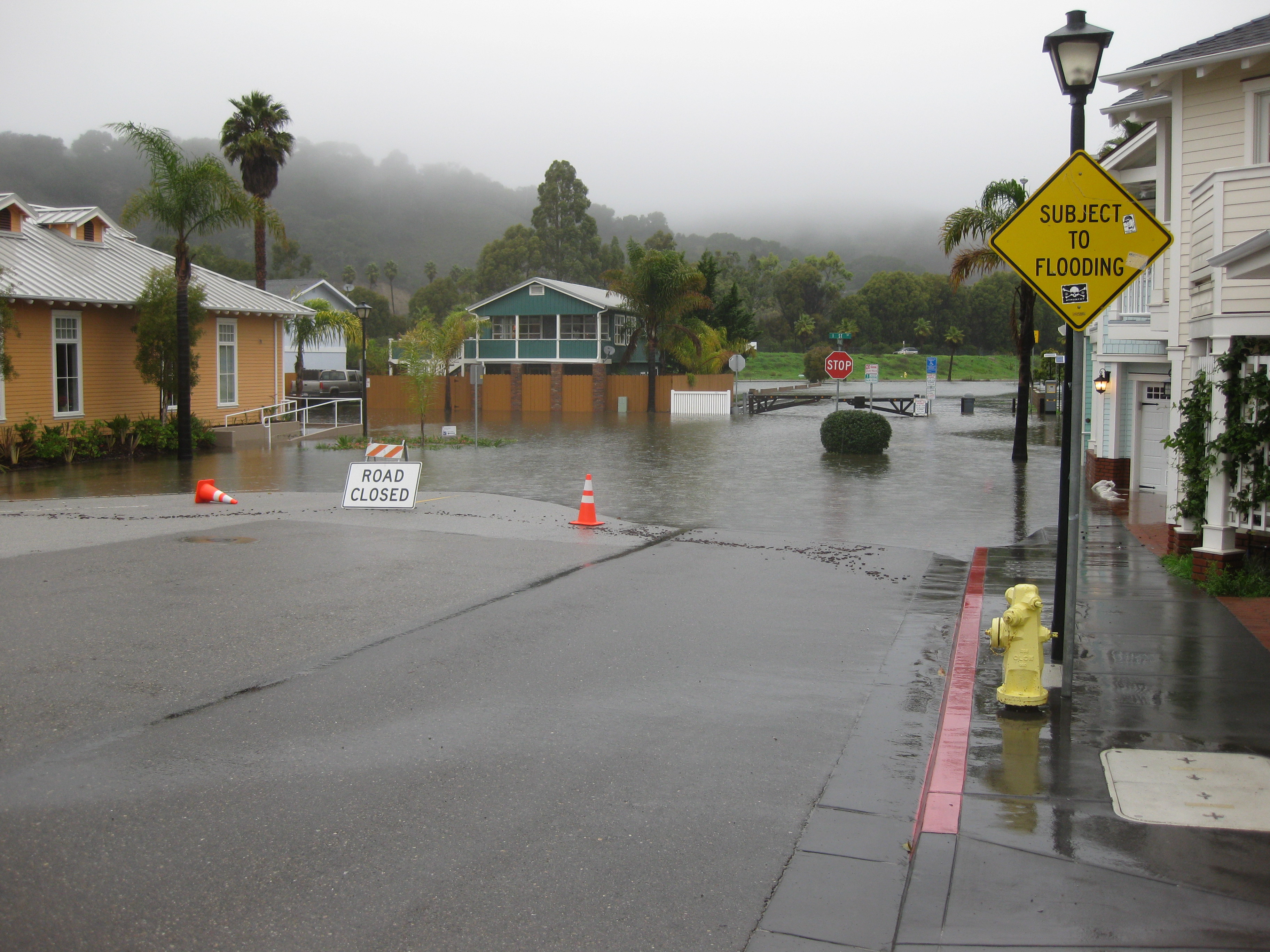
Historic Photos:
.JPG) 01/24/2024 - 1st Street Flooded
01/24/2024 - 1st Street Flooded
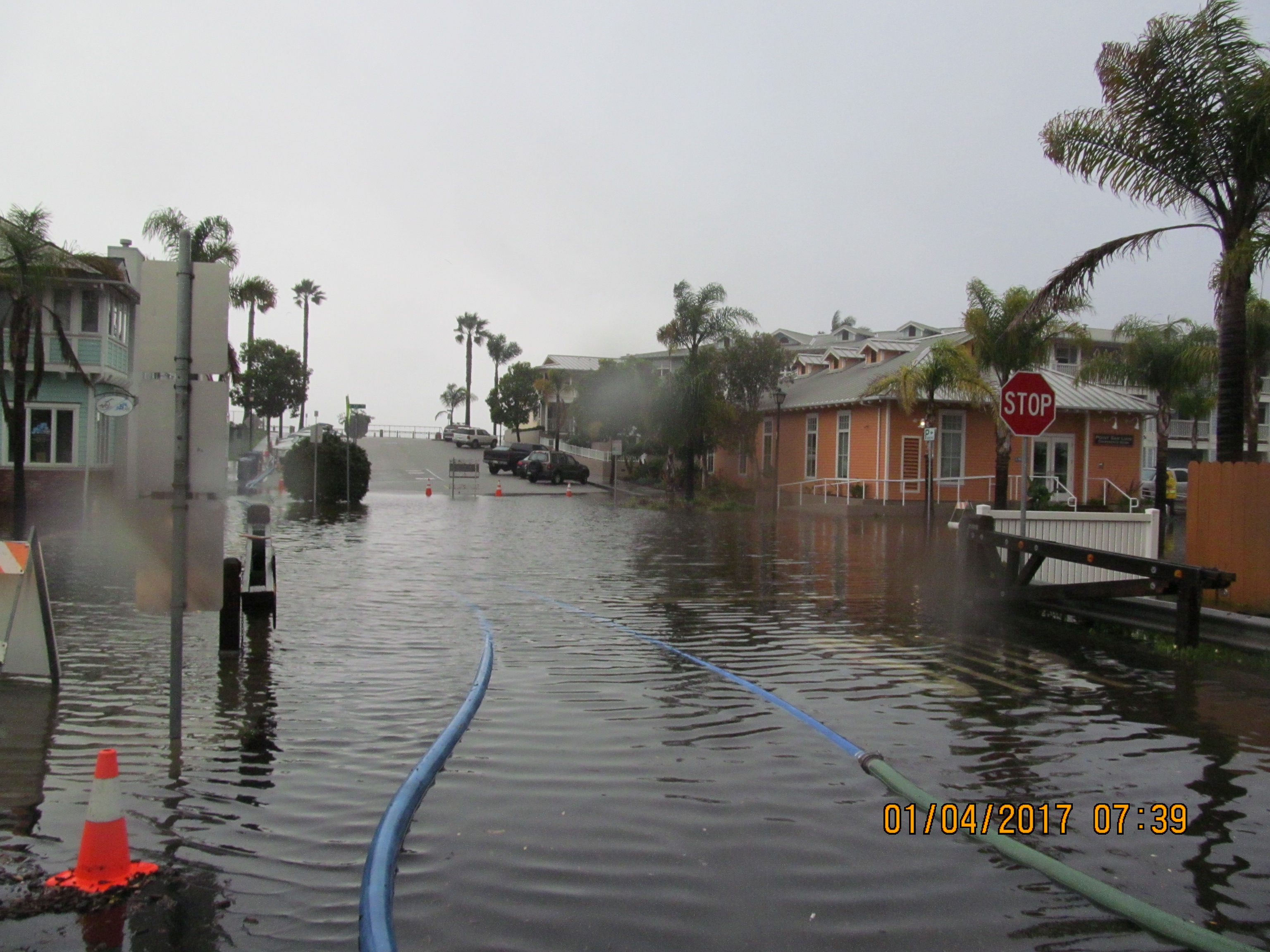 01/04/2017 - 1st Street Flooded
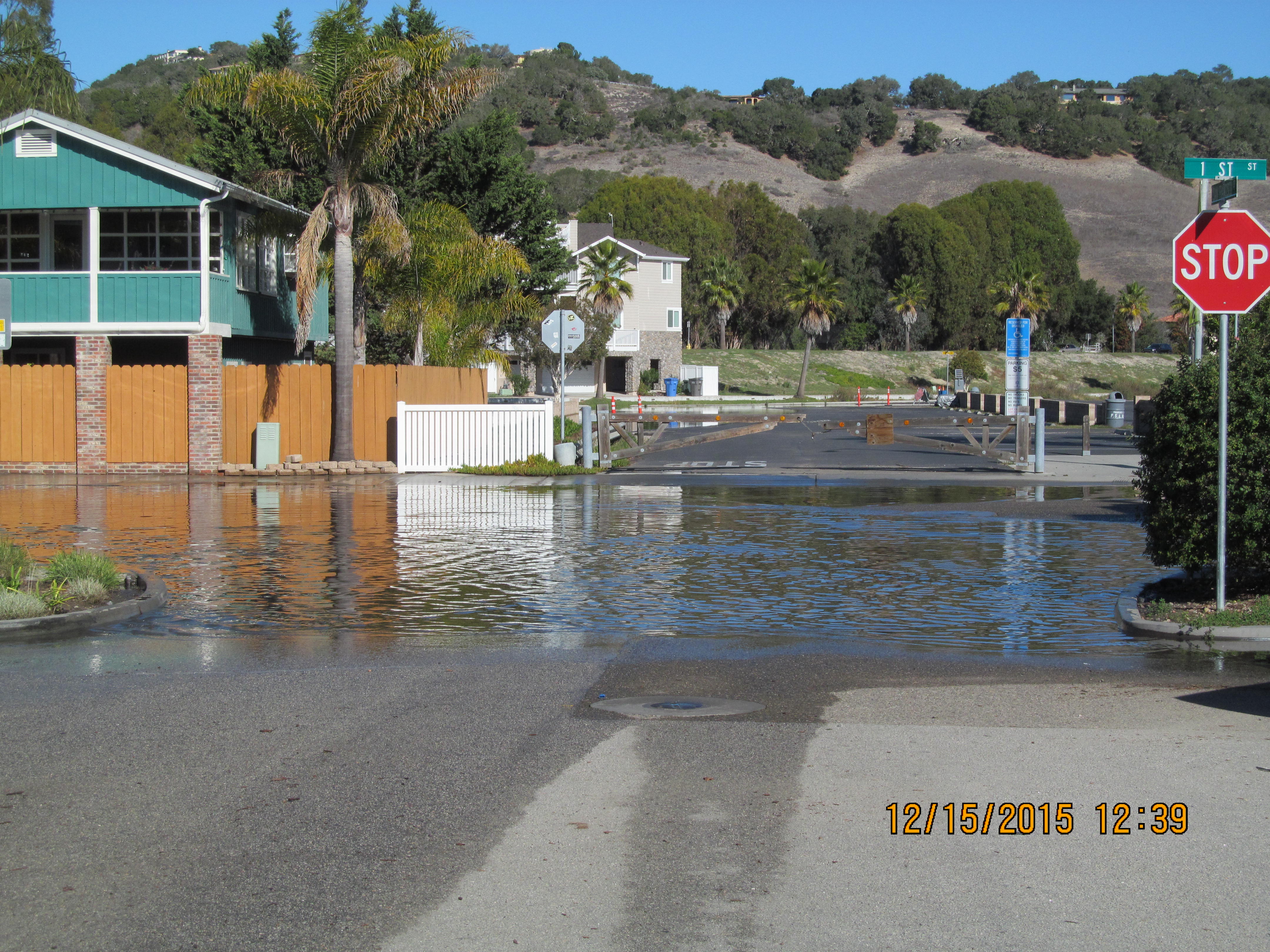 12/15/2015 - 1st Street Flooded
 01/06/2011 - 1st Street Flooded