Master Water Report and Data Information System
The San Luis Obispo County Flood Control and Water Conservation District (District) compiles and conducts analyses that communicate the current and projected future ability of water supplies to meet demands on a county-wide basis via production of a Master Water Report.
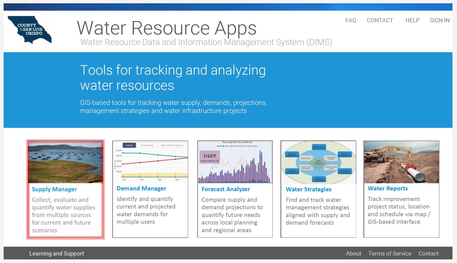
The District is in the process of updating the 2012 Master Water Report into a publicly accessible data and information system that can be maintained and updated on a regular basis to ensure that these analyses can be kept up to date. This will support timely decision making regarding how to address water supply and demand issues, including County land use and housing policies and programs overseen by the County’s Planning Department. The reporting system will be web-based, and include water supply and demand information at various geographic scales and address county-wide drought planning requirements.

Project Goals
The Master Water Report and Information System Development Project has the following
goals:
- Create a web-based and GIS-based Data and Information System (DIMS) to automate tracking and reporting of information and data needed to analyze current and future water supply and demand, to be hosted and managed by the District
- Track water supply, conservation, recycled water and other water-related projects and programs throughout District
- Provide most up-to-date data and analysis of current and future water supply and demand balances to inform decision-makers and the public
- Generate bi-annual countywide water resources reports
- Generate incidental water snapshot reports for specific agency or areas in SLO County as needed
- Data and reports to be scalable via multiple scales, i.e. Countywide, Water Planning Areas (6), Watersheds (up to 25), etc.
- Automation of Regional Water Infrastructure Resiliency Plan analysis
- Provides water supply data for basis of project-specific EIR’s and updates to community plans, specific plans, and other Planning and Building Department documents/plans
Project Schedule & Work Plan
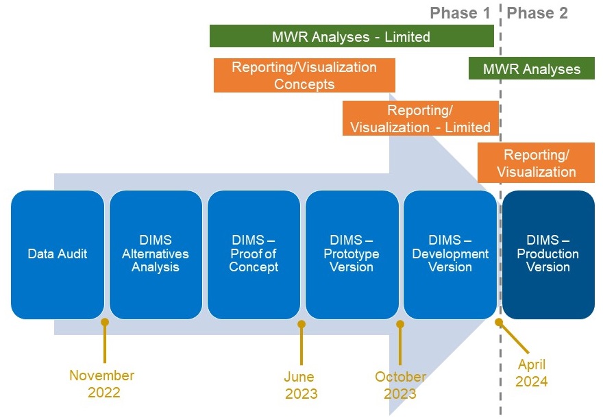
The Project is split into two phases. The primary goal of Phase 1 is to complete a working "Development Version" that provides working functionality of the Current and Future Supply and Demand scenarios and the resiliency scoring defined in the Regional Water Infrastructure Resiliency Plan. Phase 1 is focusing on Water Planning Area 2 The timeline for Phase 1 is below:

Phase 2 of the Project will take the functionality of Phase 1 and apply it to the other Water Planning Areas. Additional reports and functionality will be included as well. The exact scope of Phase 2 is being developed now.
Project Work Plan
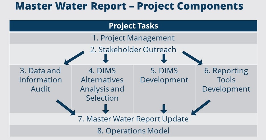
The Overall Work Plan of the project is listed below.

Project Contacts
For questions or additional information please contact Brendan Clark via email or phone: (805) 788-2316.
